
Search results for: SkyTruth
SkyTruth: Using Satellites to Protect the Planet

SkyTruth uses satellite imagery and other technology to protect the environment. They identify and monitor threats in order to make environmental concerns more visible and motivate people to take action to protect the planet. Skytruth’s innovative use of federal data and satellite imagery gives activists and legislators what they need to enforce existing laws and…
Read MoreSkyTruth gives new view in the fight for the environment
The uncertain future of the coal industry has been a central figure in the media’s portrayal of the political turmoil disrupting a large swath of the United States. So too has the uncertain future of environmental policy that protects the land in coal-rich regions. It’s never been more important to be able to take a…
Read MoreSkyTruth
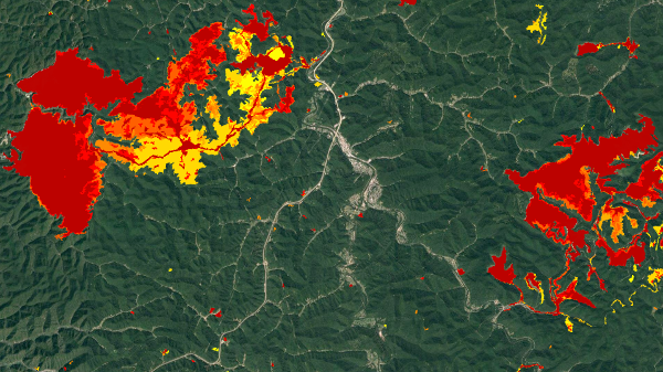
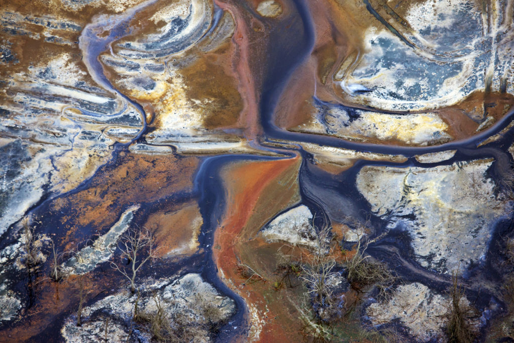
SkyTruth provides services and data on Fracking, Wastewater ponds, Mountain Top Mining sites, Global Fishing illegal fishing Watches and Oil spill monitoring. They have developed a system of creating and verifying datasets to be used in Remote Sensing Applications. (Remote Sensing is the process of creating layered maps from disparate sources to collect data needed to…
Read MoreLightHawk: The Power of Aerial Images to Benefit Conservation
Seeing is believing. It’s an idea at the cornerstone of the work we do as a non-partisan conservation non-profit group. We believe that people will make the right decision when given a clear picture of an issue and what’s at stake. We have seen the magic of the aerial perspective at work for some of…
Read MoreHumanist Grants present evidence-based solutions in new beneficiaries
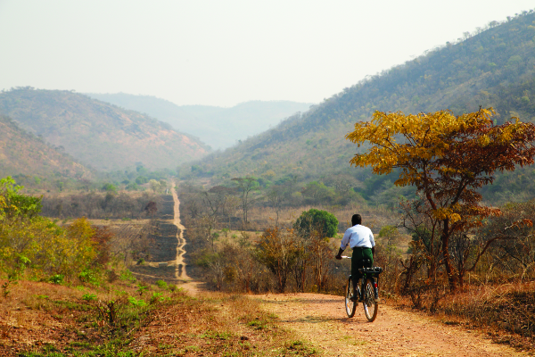
Foundation Beyond Belief’s Humanist Grants program chose four beneficiaries this quarter that highlight the use of evidence-based solutions in their methodology. Our new Poverty and Health beneficiary, World Bicycle Relief, lives by the motto, “Do it right, even if it takes a little longer,” which is why they used a long pilot period to test…
Read More